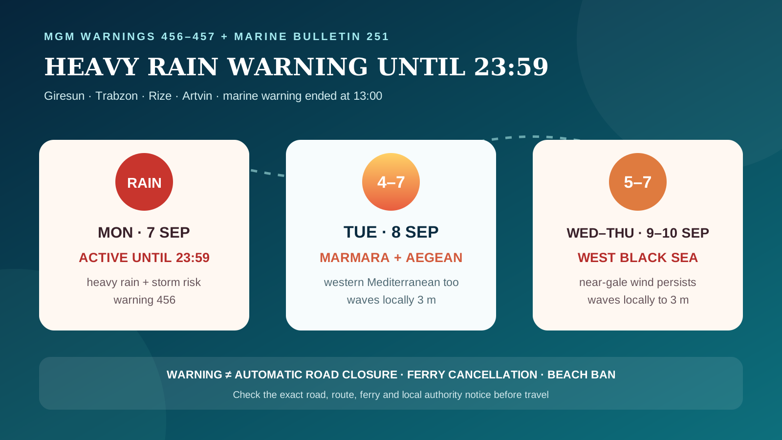
Türkiye's State Meteorological Service (MGM) marine warning No. 457 completed its official validity window at 13:00 on Monday, 7 September 2026. Warning No. 456 remains active until 23:59 for locally heavy rain in eastern Giresun, western and eastern districts of Trabzon, all of Rize and northern Artvin. MGM has also replaced the earlier sea forecast with bulletin No. 251, valid from 8 to 10 September. It keeps near-gale conditions across western sea routes and extends the outlook through Thursday.
New warning for Monday: four eastern Black Sea provinces
MGM expects showers and thunderstorms to become locally heavy from Monday morning in eastern Giresun, the western and eastern districts of Trabzon, Rize province and northern Artvin. Warning No. 456 runs from 06:00 to 23:59 on 7 September. People travelling on coastal and mountain roads should allow extra time, avoid floodwater and monitor governorate, municipality and road-authority notices; the national warning does not identify a blanket road closure.
Marine warning No. 457 ended at 13:00
The dedicated marine warning covered westerly and south-westerly winds at force 6–8, equivalent to 50–75 km/h, in the eastern sector from 01:00 to 13:00. Its official period is now over. This does not certify the status of any individual ferry or port and does not guarantee immediately calm local seas; passengers should still check the operator and port before departure.
Tuesday, 8 September: western waters remain exposed
Bulletin 251 forecasts force 4–6 winds, locally force 7, in the Marmara. The Aegean may reach force 5–7 in the north and locally in the south, with waves of 1.5–2.5 metres and locally three metres. The western Antalya Gulf may also reach force 5–7 in the morning. In the Black Sea, waves are forecast at one to two metres, rising to 1.5–3 metres in the west, while heavy rain remains possible in the east.
Wednesday and Thursday: western Black Sea risk persists
On 9 September, the eastern sector of the western Black Sea may reach force 5–7, with waves locally at three metres. The Marmara remains at force 4–6 and locally 7, while the northern Aegean is forecast mainly at force 5–7. On 10 September, force 5–7 winds and locally three-metre waves remain possible in the western Black Sea; the Marmara and northern Aegean ease to force 3–5, locally 6.
What travellers should check
Confirm the exact ferry or excursion with the operator shortly before departure and check the relevant port authority or local authority notice. For yacht and day-cruise bookings, verify the return leg and refund or rebooking terms. Beach users should follow municipal notices and lifeguard flags because a national marine forecast can lead to a local restriction, but does not create one automatically.
Turkey Compass assessment
Confirmed: warning 456 remains the active land alert until late Monday. From Tuesday, bulletin 251 shifts the practical travel focus to Marmara, Aegean, western Mediterranean and then western Black Sea routes through Thursday. Misleading: claiming all ferries are cancelled, all ports are closed or Türkiye's entire coast is under a swimming ban without a route- or location-specific official decision.
Archive note
This continuing file originally tracked the 29–31 August warning cycle and later warnings 455 and 457. They are no longer active. Warning 456 remains active until 23:59 on 7 September. Marine bulletin 251 supersedes bulletin 250 and covers 8–10 September.